EXPLORE PLACES THROUGH TIME
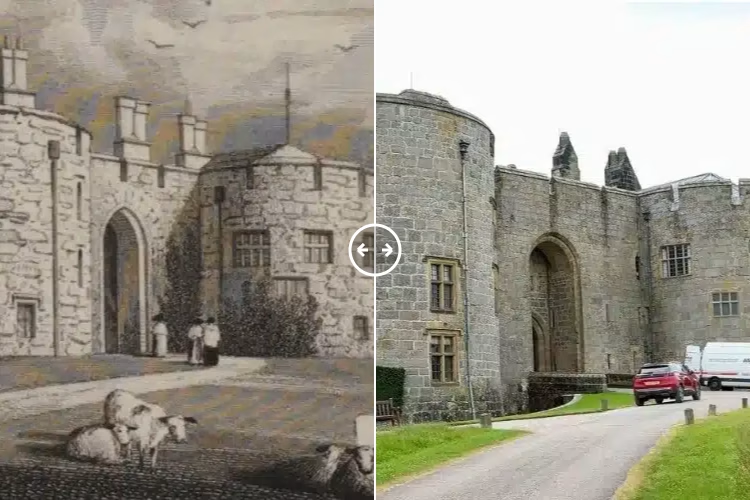
Chirk, Wrexham County Borough, Wales Then & Now
Discover how Chirk, Wrexham County Borough, Wales has changed through historic and modern photographs.
A little history of Chirk, Wrexham County Borough, Wales
Chirk, Wrexham County Borough, Wales
Chirk, known in Welsh as Y Waun, is a town and community in Wrexham County Borough, Wales, situated approximately 10 miles south of Wrexham and 5 miles north of Oswestry. The town lies on the border with the English county of Shropshire, across the River Ceiriog. At the 2011 census, Chirk had a population of 4,468.
Historically, Chirk was part of the traditional county of Denbighshire and later Clwyd, before becoming part of Wrexham County Borough in 1996. The town is renowned for Chirk Castle, a medieval fortress built in 1295 by Roger Mortimer de Chirk, which served as a stronghold during Edward I's conquest of Wales. The castle remains a significant historical landmark in the area.
Another notable feature is the Chirk Aqueduct, constructed between 1796 and 1801 by Thomas Telford and William Jessop. This aqueduct carries the Llangollen Canal over the River Ceiriog and is part of the UNESCO World Heritage Site that includes the Pontcysyllte Aqueduct.
The town's economy has evolved over time, with coal mining being a primary industry from 1622 until 1968. In recent years, Chirk has diversified, with the establishment of a Cadbury chocolate factory in 1969, which produces drinking chocolate and chocolate crumb.
Chirk's rich history and heritage are reflected in its well-preserved architecture and landmarks, making it a significant location for historical study and preservation.
Explore Chirk, Wrexham County Borough, Wales comparisons